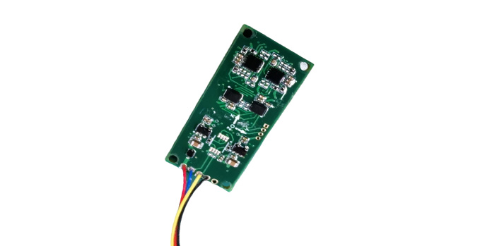
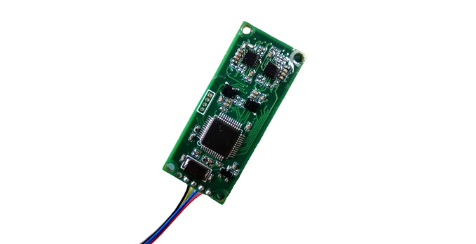
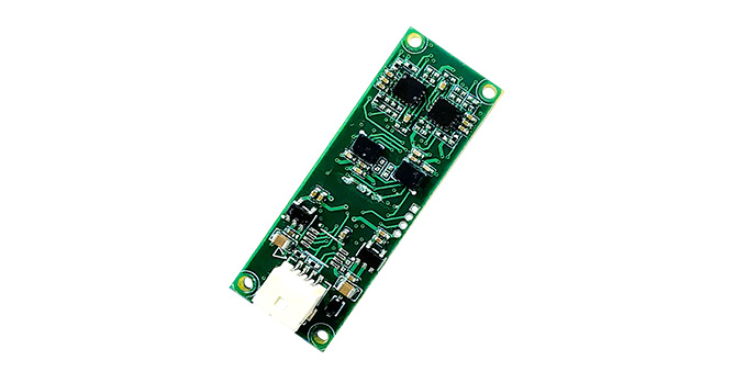
The C336 product is a high-precision, low-power digital magnetic compass independently developed by our company. It integrates a three-axis magnetic sensor, a three-axis acceleration sensor, and a temperature sensor. It adopts the self-developed spatial calibration technology and can quickly calibrate the magnetic interference that is widely present on users' equipment. After successful calibration, It can output high-precision azimuth, pitch, roll Angle, as well as temperature, three-axis magnetic field, three-axis acceleration and other data. In addition, it is equipped with a built-in geomagnetic field model that can automatically calculate the local magnetic declination based on the input longitude, latitude and time information, achieving automatic conversion between magnetic north and true north. It can provide multiple baud rates and different output modes for users to choose from. It features high precision, small size and low power consumption, and can meet users' application requirements such as orientation and pose measurement.
The C336 electronic compass can provide methods such as multi-point calibration in magnetic field space, rotational calibration in magnetic field space, planar circumferential calibration, and planar multi-point calibration to meet the application requirements of different users. When conducting calibration, the magnetic compass must be fixedly installed on the user's equipment for calibration. The multi-point calibration method in magnetic field space and the rotational calibration method in magnetic field space are applicable to small equipment that can be placed at an inclination Angle exceeding 45°. After calibration, the azimuth accuracy in a large inclination state can be guaranteed. Planar circumferential calibration and planar multi-point calibration are suitable for large and medium-sized equipment that cannot be placed at a large tilt. After calibration, only the azimuth accuracy under a small tilt state can be guaranteed.

Typical applications:
a. Aircraft - various fixed-wing aircraft and helicopters;
b. Ships - Various types of ships;
c. Unmanned systems - unmanned underwater vehicles (UUV), unmanned aerial vehicles (UAV), etc.
d. Handheld viewing and aiming system
e. Underwater towing cable attitude measurement system.
1、Core advantages: Independently developed spatial calibration technology, effectively countering magnetic interference from equipment.
2、High-precision output: Provides azimuth Angle, pitch Angle, and roll Angle (accuracy is guaranteed by calibration methods).
3、Intelligent calibration: It offers spatial calibration methods (for small devices, ensuring high inclination accuracy) and planar calibration methods (for large devices, ensuring low inclination accuracy), and must be installed for calibration.
4、True North conversion: Built-in geomagnetic model, automatically calculates the magnetic declination Angle, and outputs the true north position.
5、Multi-data output: Simultaneously output attitude Angle, three-axis magnetic field, three-axis acceleration, and temperature.
6、Flexible interface: Supports multiple baud rates and output modes.
7、Compact and low power consumption: Small in size and low in power consumption, suitable for embedded applications.

All rights reserved © Suzhou Miaohang Technology Co., LTD Filing number:Su ICP No. 19026017-
Technical support:Zhongyunshang Network